
a Natural Park
For almost 10 years, it worked on the establishment of a Natural Park. Learn more about the draft law prepared by Mada, as well as the official law that was published in the official journal on April 30th 2019.
Overview
In 2004, the Lebanese government designed a national master plan for Lebanon which included recommendations for the Upper Akkar‐ Donnieh‐ Hermel area to establish a Natural Park, in order to safeguard the extraordinary biodiversity and landscapes of the area. In 2005, Mada initiated a set of activities aimed at paving the way for the establishment of the park over a pilot area of 220 km2 in Akkar and Donnieh. These included launching biodiversity assessments (flora and bird surveys), ecological monitoring, socioeconomic surveys, the creation of a geographical information database (land use map, soil map, existing protection decisions, vegetation map, cultural heritage map), as well as implementing local economic and ecotourism initiatives.
In 2006, the municipalities of Fneideq, Hrar, Michmich, Qobayat, located in the pilot area, signed protocols of cooperation with Mada. These protocols specified the process towards a participatory map of potential land use allocations that defined priorities for future land use and took into account the park perspective. In full coordination with the concerned municipalities, the federations of Jord el Keitta and el Joumeh, and the municipality of Qobayat decided to focus the process on an area including Qamouaa and the surrounding villages – Akkar el Atiqa, Fnaideq and Qobayat. This area, covering 101 km2, would represent a pilot perimeter that could then be extended to the other municipalities upon the approval of the Natural Park Charter, once ready.
Methodology
The process towards the designation of a protected area is complex and involves numerous stakeholders including municipalities, local communities, and governmental and non governmental agencies. It requires a solid scientific basis to articulate a robust vision of and strategic orientation for future activities. Accordingly, Mada aimed to combine a scientific methodologies, networking with stakeholders, as well as tangible actions on the ground in order to support development and build trust.
All scientific assessments and specifically the biodiversity assessments (flora and avifauna) were conducted on the basis of extensive field surveys by national experts, closely backed up by a Scientific Steering Committee gathering national and international experts, academics and researchers in biodiversity conservation and sustainable management from various disciplines.
In 2008, under Mada’s supervision and support, the Federations of municipalities Al Joumeh and Jord el Keitta and the municipality of Qobayat, created specific committees to follow up the park: A Park Steering Committee (PSC) composed of representatives of these municipalities; as well as a Technical Committee (TPC) including technical members in charge of drafting the preliminary Natural Park Charter in cooperation with other national and local stakeholders.
Brief description of the park area
The Governorate of Akkar, with a total surface area of 798km 2 , is characterized by the presence of high mountains to the east and a relatively large coastal plain to the west – the second-largest agricultural plain in the country after the Bekaa Valley. Akkar is considered the most rural district of Lebanon, with 80% of residents living outside of cities and towns. Several studies have classified Akkar as one of the most deprived regions in Lebanon, with the highest overall poverty rate in the country. Akkar has the lowest average income level and highest illiteracy rate per capita in Lebanon. The region is characterized by a dense population and a high aged dependency ratio.
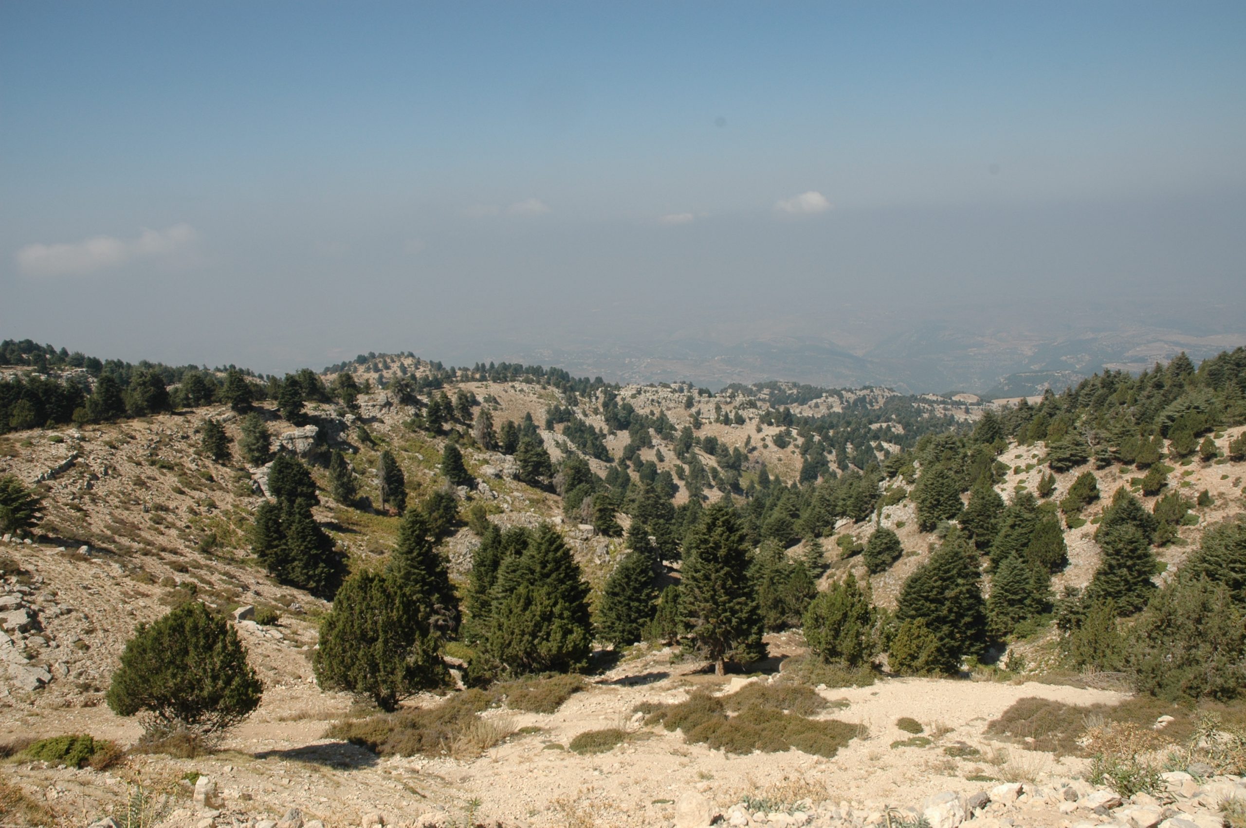
Akkar suffers from serious groundwater pollution due to the mixing of drinking water sources with wastewater and contamination through open dumping of solid waste. In the heart of the Natural Park pilot area lies the Upper Akkar territory, which extends through the mountainous areas of the Federations of el Joumeh and of Jord el Keitta and the municipality of Qobayat. The Upper Akkar territory is among the largest natural areas in Lebanon, and it is unique for its exceptional landscapes featuring continuous forest cover made up of different varieties of trees.
This forest area covers 20% to 44% of the concerned villages and lands. The Qamouaa region boasts many varieties of trees, including juniper, cedar, turkey oak, and pine. The densest turkey oak (Q. cerris) forest in Lebanon is located in Fnaideq. In addition, the territory is home to unspoiled views and picturesque villages – Qobayat, Beino and el Bire, as well as archaeological sites, such as the fortress of Akkar el Atiqa along with various Roman steles, tombs, and temples. It is home to the largest green reservoir in the country as well as important water
resources (in Qamouaa) that serve most Akkar villages. The Upper Akkar territory is one of the most deprived areas of Akkar. With an estimated population of 50,000 inhabitants, this region suffers from poverty, lack of job opportunities, poor basic infrastructure, and poor education and health services.
The establishment of a park offers potential for socio‐economic development and for the protection of natural resources through increased tourism. But before Akkar can reap the benefits of a park, there are a significant number of challenges to be addressed with the support of the public sector. Some of the obstacles are unclear land ownership, difficulties with conflict management, risk of urban expansion into forested areas, the weakness of legal protections, unsustainable activities such as quarrying and woodcutting, and improper land management. In 2011, in light of the refugee crises, Mada was prompted to modify its strategy.
The park was no longer a priority in the short-term but remained a long-term objective. Rather than engaging in emergency activities, Mada decided to continue acting as a development agency committed to the North of Lebanon, and included the new population of refugees in its activities.
However, the law for the creation of parks passed in 2019 and opened again the hope for future projects in this geographical area.
You can find below all the resources related to the park, including the draft of the law prepared by Mada, as well as the official law text that was published in the official journal on April 30th, 2019.
Our Studies
CLICK TO VIEW AND DOWNLOAD OUR STUDIES


